Find an office location
More than 175 offices from coast to coast.
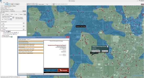
Terracon is applying big data concepts using our vast amount of historical and publicly available data regarding the subsurface to add an important first step in our geotechnical site characterization for project sites. We are predicting what we will encounter in order to maximize the efficiency of your project.
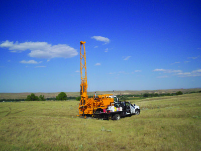
Every day, Terracon exploration teams gather information necessary to design new structures, highways, transmission lines, or other projects, and explore subsurfaces by drilling soil borings, probing with cone penetration devices, pressure meters, and the like. Each year, we generate about 5 million linear feet of new exploration data. This data is continually added to our 50+ years of project information. The aggregate value of this data is more than $1 billion, if collected in today’s fees.

We can do so much better. And we are beginning to do just that.
Terracon has introduced the Report of Expected Geotechnical Conditions (REGC). REGC combines local geotechnical engineers’ expertise with historic exploration data and related information available in the public domain of a project site. All of this data is managed through our proprietary GIS-based systems.
The result is a prediction of the geotechnical conditions that will be encountered, identification of possible geotechnical risks, and finally, suggestions of applicable foundation types for the construction project. Engineers can then consider the thoroughness and consistency o
Using the REGC provides many benefits to clients compared to the traditional way of exploring the subsurface. One advantage is the ability to develop a more effective exploration work scope for the project. This can save thousands of dollars in exploration costs.
Clients also have the benefit of a jump start for planning a project. Early cost estimating and route or site selection is much clearer when using REGC to predict the geotechnical conditions. As we learn to benefit from using big data for geotechnical site characterization, we become more confident in foundation design recommendations by comparing what we have encountered to the conditions expected and typical for the area. Greater confidence means lower priced foundation systems.
Instead of believing that the next construction site conceals a mysterious unknown subsurface awaiting discovery, the REGC process can take our profession to a level where research and analysis will determine the need to search files and public resources before heading out to the field for exploration. Thus, our teams will be more prepared than ever before to provide our clients with the most accurate information to complete projects the right way.

More than 175 offices from coast to coast.